Trinity researchers have made major breakthroughs in documenting 14th-century Ireland, using historical parish incomes to reveal in unprecedented detail the economics, politics and culture of medieval Ireland
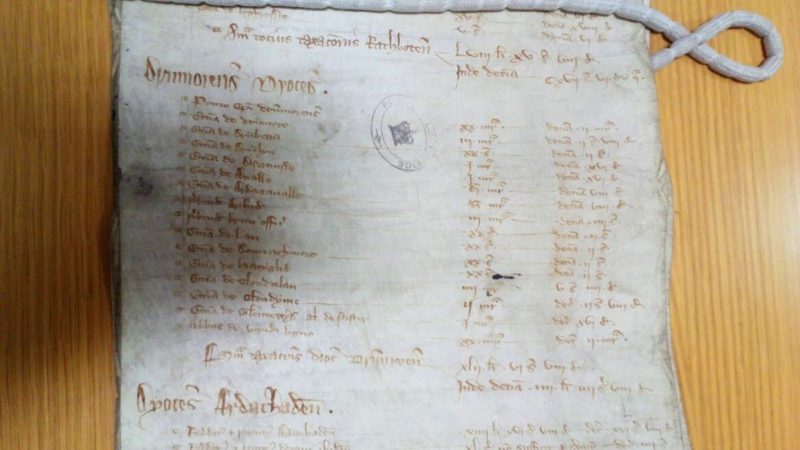
The research, led by Dr Chris Chevallier as part of his PhD, used papal assessments of ecclesiastical wealth during the reigns of Edward I and Edward II in order to explore trends.
The work puts an unprecedented level of focus on island-wide and regional trends in Ireland from 1302 to 1307, revealing new information on the aftermath of the Bruce Invasion of Ireland (1315-18) and the Great European Famine (1315-17).
Supervised by Dr Mark Hennessy from Trinity’s Department of Geography, the study contains over 50 maps detailing various cultural regions and environmental features.
The researchers found that Dublin served as the economic centre of the English colony, showing high degrees of wealth as far west as Mullingar. England did not manage to exercise full control over the Gaelic Midlands, northern Wexford, the Wicklow Mountains, and a considerable portion of the Leinster coastline.
However, the study also found data consistent with the existing theory of a “Second Pale” – a second bastion of colonial control largely based in southeast Ireland and northern Munster.
Politically, the English failed to control any province completely, with maps indicating that while colonial control in some regions was stronger than expected, it was weakened by numerous internal frontiers and semi-independent Norman-Irish lords.
In a press statement, Chevallier said: “The project is a comprehensive monograph of all this data. The final maps reflect efforts to provide accurate historical context and meet a high degree of scientific rigour. We now have a database that can illustrate multifaceted insights into medieval Ireland – even at the local level, for almost all the island.”
He added: “Although additional Irish valuations were likely destroyed in fires, my research indicates that there may be surviving transcripts made during the 19th century. These could still be among archive miscellanea or private collections. There are, however, valuations and receipts for much of Europe that offer invaluable opportunities for mapping and analysis.”
“Outside of the maps of Ireland”, he said, “I’ve been working on data for Bangor, Norwich, Besançon, Belley, and Lausanne. I’m particularly interested in how the Black Death and climate change impacted valuations”.